Scene 1 (0s)
[Audio] Good afternoon, everyone. Today, our discussion will focus on the geography of the world. This topic explores both the physical and human aspects of our planet. Starting from its Greek origins, the word "geography" means "earth" and "writing." We will also cover modern methods such as location determination and environmental impacts. Through this exploration, we will gain a better understanding of the rich and diverse world we live in. So, let's start our journey of learning about the world around us. Welcome to the first slide of our presentation, "Lesson 1: The Geography of the World..
Scene 2 (38s)
[Audio] Today, I will be discussing the topic of geography. This subject covers a wide range of aspects related to our world and is crucial for comprehending our planet. Let's start with slide number 2, titled "Lesson 1: The Geography of the World." On this slide, the text explains that the word 'geography' comes from the Greek words 'graphein' which means 'writing' and 'geo' which means 'earth' or 'land.' This literal definition reflects the focus and importance of geography as the study of the Earth and its physical features. As we can see, the word's roots give us a glimpse into the field's scope. It encompasses everything from mountains to oceans and everything in between. This brings us to the end of our second slide. I hope this brief introduction has sparked your interest and given you a better understanding of what geography truly means. Let's move on to the next slide for more fascinating information about our world..
Scene 3 (1m 43s)
[Audio] Slide number 3 introduces our first lesson - The Geography of the World. Geography is the study of the physical characteristics of the world and how humans interact with their environment. This subject has been essential in understanding our world for centuries. In this lesson, we will explore various aspects of geography, including physical features, climate, and natural resources. We will also examine human adaptation and interaction with their surroundings. Understanding the geography of our world is crucial in gaining a deeper appreciation and comprehension of our diverse and complex planet. It also guides us in making informed decisions about our impact on the environment. Let us continue with this lesson and discover the fascinating world of geography..
Scene 4 (2m 32s)
[Audio] In this lesson, we will discuss the geography of our world, which encompasses both physical features and human inhabitants. The first main theme is location, referring to a place's position on the Earth's surface. This can be described by latitude and longitude or its relationship to other places. Location is important in understanding connections and impacts between places. The second theme we will explore is place, which includes both natural features like landforms and bodies of water, and human elements such as culture and language. By studying a place's characteristics, we can understand its unique identity and how it affects its inhabitants. In summary, geography covers a wide range of topics, but we will focus on location and place in this presentation. By understanding these themes, we can gain a deeper understanding of our world and its people. We will continue our exploration of the world's geography in the rest of this presentation..
Scene 5 (3m 35s)
[Audio] Slide 5 will cover two methods for determining location: absolute and relative. These methods are essential for understanding the geography of our world. The first method, absolute, involves using specific coordinates like latitude and longitude to pinpoint a location accurately. In contrast, the relative method considers a location in relation to other places, making it more subjective and variable based on the reference point. Each method has its own advantages and limitations, and it is crucial to familiarize ourselves with both in order to fully grasp the geography of our world. As we continue our journey through the geography of our world, remember the importance and distinctions between these two methods..
Scene 6 (4m 24s)
[Audio] To determine the precise location of a place, we use imaginary lines called the geographic grid, consisting of the equator, prime meridian, and International Date Line. The equator divides the Earth into the Northern and Southern Hemisphere, while the prime meridian divides it into the Eastern and Western Hemisphere. The International Date Line marks the start of each new day. These lines intersect to create a grid system that helps us locate any point on Earth using coordinates, known as latitude and longitude. Latitude measures north or south of the equator, and longitude measures east or west of the prime meridian. This geographic grid is essential for navigation, mapmaking, and understanding the physical and cultural features of different regions on our planet. It also helps us understand the relationship between places and their connections. Though they may not physically exist, these imaginary lines play a crucial role in our understanding and interaction with the world. Next time you look at a map, remember the significance of the geographic grid - it is more than just lines on a page, but a key tool for understanding the geography of our planet. Thank you for listening. Stay tuned for our next topic, "The Continents and Oceans..
Scene 7 (5m 41s)
[Audio] We will now focus on slide number 7 where two important concepts in geography will be discussed - longitude and latitude. The Prime Meridian is a vertical line that runs from the North Pole to the South Pole and serves as the reference point for measuring longitude. Latitude, on the other hand, is represented by the equator, a horizontal line that divides the Earth into the Northern and Southern Hemispheres. The equator is also known as the main line of latitude. These two lines work together to help us locate and navigate places on the Earth's surface. Understanding longitude and latitude is essential in the study of geography. Let's move on to the next slide..
Scene 8 (6m 27s)
[image]. [image].
Scene 9 (6m 33s)
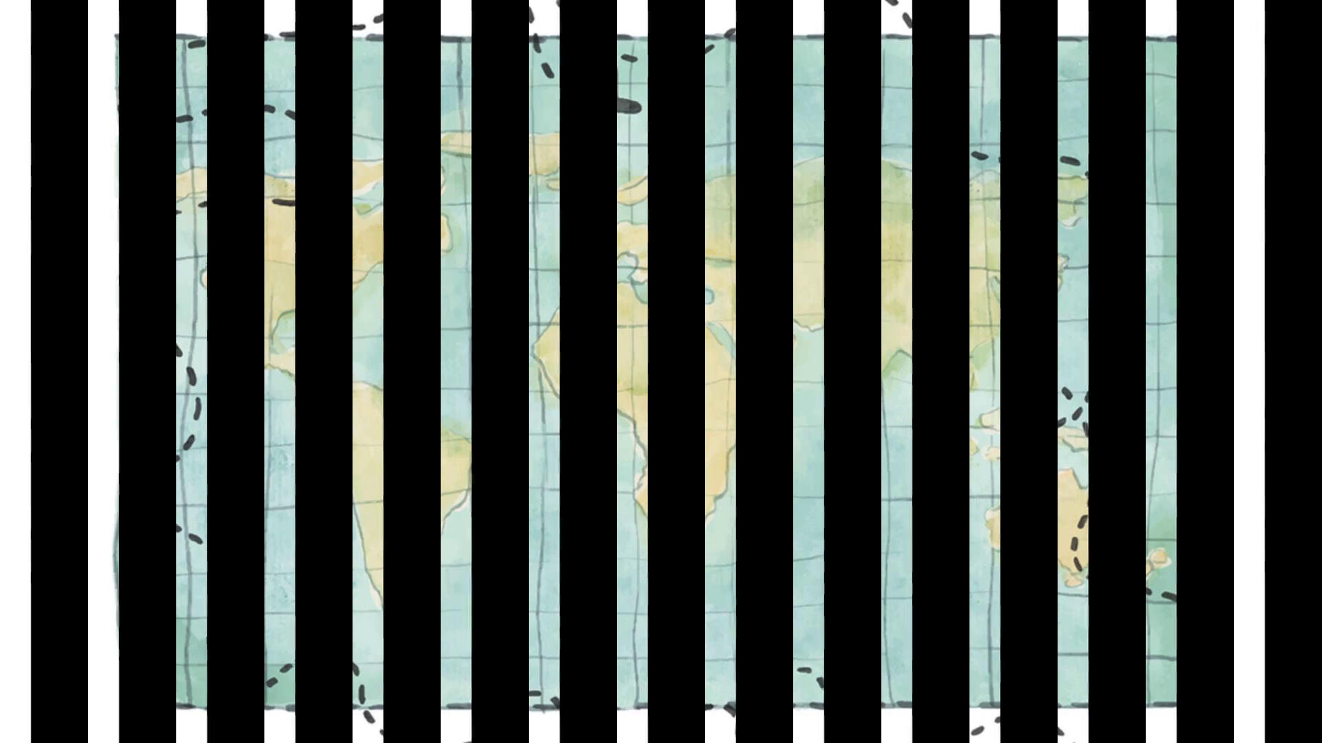
[Audio] Our topic is Geography and we are currently on slide number 9. This image shows the world map with its continents and oceans. The horizontal and vertical lines on the map are called latitude and longitude, which help us in locating places. The largest ocean is the Pacific Ocean and it covers a large area. The Arctic Ocean is in the north, the Atlantic Ocean is in the west, and the Southern Ocean is in the south. Moving on, let's look at the countries on this map. The USA has 50 states, while Canada is our neighbor to the north. To the east, we have Russia and Turkey, which spans both Europe and Asia. Australia is located in the southern hemisphere and is known for its diverse wildlife and natural beauty. Lastly, Japan, situated in the Pacific Ocean, is a beautiful island country. This map shows us the different countries and their locations in the world. Thank you for your attention..
Scene 10 (7m 34s)
[Audio] Slide number 10 of our presentation on "Lesson 1: The Geography of the World" discusses the concepts of relative location and the binary system of land and water. In geography, we use the term "relative location" to describe a place's position in relation to other places. This is crucial for understanding the physical and human characteristics of a region. The binary system of land and water, also known as the visual and insular system, divides the earth's surface into two parts. This has greatly influenced human societies and the distribution of natural resources, as well as the political boundaries of countries. The possession of land and control of waterways have played key roles in the rise and fall of empires throughout history. These concepts are fundamental in understanding the world and its functioning. Let us now proceed to the next slide..
Scene 11 (8m 33s)
[Audio] In this discussion, we will focus on the geography of the world, also known as "Ang Heograpiya ng Daigdig." Slide number 11 will demonstrate how physical features and neighboring countries play a significant role in determining the location of a place. By visualizing the landforms and surrounding countries, we can accurately identify the position of a place. For instance, the Philippines is located south of Taiwan, China, and Japan; east of Vietnam, Laos, Thailand, and Malaysia; west of Guam, Marianas, and Palau; and north of Borneo, Brunei, and Indonesia. This system enables us to understand the connections between different locations and how they are influenced by their surroundings. It also provides insight into the interconnectedness of various regions and how they impact one another. Let's continue to the following slide, where we will delve deeper into the geography of the world..
Scene 12 (9m 36s)
[Audio] Let's now shift our focus towards the concept of insularity, which refers to a place's location based on the surrounding bodies of water. For instance, the Philippines is situated near the Bashi Channel, West Philippine Sea, Pacific Ocean, and Celebes Sea, which serve as natural boundaries and greatly influence the country's geography. This concept also applies to other countries and regions, as their position on the globe is determined by the surrounding bodies of water. This can have an impact on their climate, natural resources, and connections to other nations. Understanding insularity is crucial in comprehending the diverse landscapes of our world and highlights the importance of geographic features such as islands, peninsulas, and archipelagos. In the upcoming slide, we will delve deeper into how insularity affects the geography of a place and its people. Let's continue exploring the fascinating world of geography..
Scene 13 (10m 37s)
[Audio] Today, we will be discussing the geography of the world. The world is made up of various regions that share similar features, such as climate, landforms, bodies of water, and cultural aspects like language and religion. One important aspect of geography is the relationship between humans and their environment. This includes how people adapt to their surroundings, use available resources, and shape the land and its features. We will also explore the concept of regions and how they are defined. Regions are not just determined by geography, but also by culture, politics, and economics. Each region has its own unique characteristics and is influenced by the people who live there. As we move on to the next slide, remember to consider the different elements and factors that contribute to the formation of a region. These include physical features of the land and human interactions. Let's continue our journey through the geography of the world and discover the fascinating interplay between people and their surroundings..
Scene 14 (11m 42s)
[Audio] Our next topic is the concept of Movement in Geography. This refers to the movement of people, goods, and ideas from one place to another. In Geography, we focus on several themes, one of which is the movement of people. This includes migration for economic, social, or political reasons, which affects both the people and the places involved. Another aspect of movement is the transportation of goods, which is essential for the global economy. This involves various modes of transportation and has a significant impact on the environment and society. Lastly, the movement of ideas plays a crucial role in shaping the world. Globalization and technology advancements have made it easier for ideas to spread and influence people's thoughts and actions. Understanding the different forms of movement is crucial in understanding the interconnectedness of our world and the ripple effect of our actions on a global scale. Now, let's continue exploring the Geography of our world and delve into the different themes. Hopefully, you have a better understanding of Movement in Geography..
Scene 15 (12m 53s)
[Audio] Slide number 15 will cover the structure of our world, which is made up of solid, liquid, and gas elements. The majority of the earth is composed of solid materials called the lithosphere, including the inner core, outer core, and mantle. These elements work together to shape the geography of our world and each has an important role to play. Let's examine the significance of each element in our world's geography..
Scene 16 (13m 20s)
[Audio] We will now explore the hydrosphere, which makes up 75% of the Earth's surface. It consists of oceans, seas, rivers, lakes, and other water forms that shape the land. The hydrosphere is vital to life on Earth, providing essential resources and playing a role in regulating temperature and climate. As we gain a better understanding of the hydrosphere, we can work towards preserving and protecting it for future generations. As we continue our journey through the geography of the world, we will learn more about the diverse and ever-changing features of the Earth..
Scene 17 (13m 57s)
[Audio] In slide number 17, we will discuss the atmosphere, the gas that surrounds our planet and gives life to humans, animals, and plants. The atmosphere is primarily made up of nitrogen at 78% and oxygen at 20%, with small amounts of argon and other gases. These gases are crucial for the survival of life on Earth. The atmosphere also regulates temperature, protects us from harmful radiation, and distributes essential nutrients and water across the globe, creating a harmonious environment for all living beings. The composition and functions of the atmosphere are vital for the stability of our planet and the continuation of life. It is important that we continue to protect and preserve the atmosphere for the well-being of all living things on Earth. Let us now move on to the next slide..
Scene 18 (14m 50s)
[Audio] As we continue our journey through the geography of the world, we come to a crucial aspect - the structure of our planet. The four major layers that make up the Earth are represented in this slide. The first is the atmosphere, consisting of gases that surround our planet. It is responsible for providing oxygen, absorbing harmful radiation, and regulating the temperature. The biosphere includes all living things on Earth, such as plants, animals, and microorganisms, and is closely connected to the atmosphere and other layers. Next is the lithosphere, which is the solid outer part of the Earth, including the crust and upper mantle. The crust, shown in the image, has an average thickness of 5 to 40 kilometers. Beneath the crust is the mantle, extending to a depth of 2,900 kilometers and consisting of solid rock with pockets of molten material. The outer core is composed of liquid iron and nickel and surrounds the inner core, playing a crucial role in creating Earth's magnetic field. At the center of our planet is the hottest and most dense layer, the inner core, with temperatures reaching 5,400 degrees Celsius. Understanding the Earth's structure is important in comprehending its functioning and evolution. With this knowledge, we gain a deeper appreciation for the complex and interconnected systems that make up our planet..
Scene 19 (16m 21s)
[Audio] In slide number 19, we will be discussing 'Pag-aaral sa ibabaw ng lupa' or the study of the Earth's surface. This is an essential part of our first lesson, which focuses on the world's geography. On this slide, we will be examining the topography of the Earth. Topography refers to the physical features and characteristics of a specific area, including its elevation, terrain, and landforms. Studying topography allows us to gain a deeper understanding of the Earth's surface and how it has evolved over time. The image shows that the Earth is composed of various landforms, from towering mountains and rolling hills to vast plains. Each of these landforms plays a critical role in shaping the environment and influencing the life that exists on it. Understanding the topography of the Earth is not only essential for geographical knowledge, but also for practical purposes like land development, construction, and disaster preparedness. By studying the Earth's topography, we can make more informed and sustainable decisions for the betterment of our planet and its inhabitants. Let us take a moment to marvel at the intricate and ever-changing topography of our planet and how it has shaped the diverse landscapes we call home. In conclusion, we will now move on to our next topic..
Scene 20 (17m 48s)
ANYONG LUPA.
Scene 21 (17m 54s)
[Audio] In slide number 21, we will now discuss the geography of our world. A large part of our planet is covered by land, divided into different continents such as [list the continents]. Each continent has its own unique characteristics and features, making it distinct from the others. From the snow-capped mountains of Asia to the vast deserts of Africa, our world is full of diverse landscapes and environments. Let's explore some of the continents and their individual characteristics. We will continue our exploration of the geography of the world by delving into the fascinating world of continents..
Scene 22 (18m 31s)
[Audio] The concept of continental drift was proposed by German geologist Alfred Wegener. He believed that there was once a single mass of land known as Pangaea, surrounded by one large ocean called Panthalassa. Approximately 200 million years ago, Pangaea split apart and formed two separate land masses, Gondwanaland and Laurasia. Through the process of evolution, these two land masses eventually developed into the continents we know today. This theory has been widely accepted by the scientific community and has greatly influenced our understanding of Earth's geography. Thanks to this knowledge, we are able to gain a deeper understanding of the planet's history and how it continues to change and evolve..
Scene 24 (19m 24s)
[Audio] During his travels, Prussian geographer, naturalist, and explorer Von Humboldt put forth an intriguing proposal. He believed that the continents surrounding the Atlantic Ocean were once joined together. This theory was based on his observations of similar land formations and flora and fauna among the continents. Von Humboldt's proposal challenged the prevailing belief that the continents were fixed and unchanging. He gathered evidence and data to support his theory and made significant contributions to the field of geography. This sparked further research and led to the development of the widely accepted theory of continental drift. Von Humboldt's work serves as a reminder to keep an open mind and continuously challenge existing beliefs and theories as we explore and learn about our world. On slide 24 out of 50, we briefly touched upon Von Humboldt's proposal and its impact. This is just one of the many fascinating topics we will cover in our study of the Geography of the World. Let's move on to the next slide..
Scene 25 (20m 31s)
[Audio] In slide number 25, we will discuss the Geology of the World and the Plate Tectonics Theory, which was formed in 1960. According to this theory, the continents are located on plates that float on magma and range from 30 to 60 miles in thickness. These plates are constantly moving, leading to significant geological events like earthquakes and volcanic eruptions. The Plate Tectonics Theory has greatly enhanced our understanding of the Earth's landscape and is continuously studied and developed by geologists globally. In the next slide, we will further delve into the intriguing world of Plate Tectonics..
Scene 26 (21m 12s)
[Audio] Slide number 26 will cover smaller land masses known as islands, which are surrounded by water and come in different shapes and sizes. Some are able to support their own ecosystems while others are very small. Despite their size, islands are significant in shaping our planet's geography. Let's continue to the next slide..
Scene 27 (21m 34s)
[Audio] Next, we will be discussing the geographical features of our world. Our planet is primarily land surrounded by water and connected by continents. One prominent geographical feature we will focus on is the peninsula. A peninsula, known as a "tangway" in the Filipino language, is a large piece of land surrounded by water on three sides and attached to a larger landmass, making it unique. Peninsulas can be found worldwide, including the Iberian peninsula in Europe and the Arabian peninsula in Asia, and have played a significant role in shaping the history and culture of civilizations. The image on the slide shows that peninsulas are typically narrow and elongated and provide a natural harbor for boats and ships. They are also popular tourist destinations due to their beautiful beaches and scenic views. This concludes our discussion on peninsulas, and in our next slide, we will explore another fascinating geographical feature on our journey through the geography of our world..
Scene 28 (22m 38s)
[Audio] The next topic is slide number 28, where we will be discussing the concept of 'Isthmus', known as 'Dalahikan' in Tagalog. An isthmus is a narrow strip of land that connects two larger land masses and has an important role in linking and separating continents and oceans. It serves as a crucial transportation route for both people and goods. Some well-known examples of isthmuses are the Panama Canal and the Isthmus of Corinth in Greece. Now that we have a better understanding of this geographical term, let's proceed to the next slide..
Scene 29 (23m 16s)
[Audio] Slide 29: The fifth landform on our list is the volcano. These structures are formed by high elevations of land and erupt magma, lava, and large rocks. Volcanoes are powerful and dynamic forces in nature, shaping the world's geography and affecting the lives of those around it. They can be found in various parts of the world, each with its own unique characteristics and history. It is important to understand the significance of volcanoes in our lesson on the geography of our world. They can create new land, provide fertile soil for agriculture, and even impact our climate. However, with their beauty also comes the potential for danger. Volcanic eruptions can be catastrophic and cause destruction and loss of life. This highlights the importance of studying and understanding the forces that shape our planet. Let's continue exploring and learning about the different landforms, including the fascinating volcano..
Scene 30 (24m 21s)
[Audio] In this section, we will be exploring the geographical features of our planet. Specifically, we will be focusing on the various types of landforms that exist on the Earth's surface. Let's continue to slide 30. This slide presents a common landform found in the lower areas of mountains, known as a hill. These are elevated areas of land that rise above the surrounding terrain and have a rounded or sloped peak. Hills are created through natural processes such as erosion, tectonic movements, and volcanic activity. While not as dramatic as mountains, hills still play a significant role in our environment. They provide fertile land for farming and act as natural barriers against strong winds and floods. In addition, hills offer stunning views and are popular tourist destinations. So the next time you encounter a hill, take a moment to appreciate its beauty and significance in our world. Moving on to the next slide, we will be discussing another type of landform - the plateau..
Scene 31 (25m 23s)
[Audio] Today, we will be discussing the highest form of land, which is known as a mountain. Mountains are typically defined as landforms that rise at least 2000 feet above sea level. They are formed through various geological processes such as tectonic plate movement, volcanic activity, and erosion. These majestic structures can be found all over the world, with some of the tallest peaks being Mount Everest in the Himalayas and Mount Kilimanjaro in Africa. Mountains are not only important for their impressive size, but they also have significant impacts on our planet. They play a crucial role in regulating the Earth's climate and are home to diverse ecosystems and species. In terms of human activity, mountains have been used for agriculture, mining, and tourism. They also provide important sources of freshwater for surrounding areas. But despite their importance, mountains are also vulnerable to environmental issues such as deforestation, erosion, and climate change. It is essential for us to protect and preserve these vital landforms for the sake of our planet and its inhabitants. We have come to the end of our discussion on mountains. Join us for our next slide as we continue to explore the geography of our world..
Scene 32 (26m 44s)
[Audio] Slide number 32 out of 50: This slide is a part of Lesson 1, "The Geography of the World". Let's discuss the eighth type of landforms, which is "Plains". Plains are expansive and flat landforms, covering large areas of the Earth's surface. They are ideal for farming and human settlements due to their lack of significant changes in elevation. In terms of geology, plains can be formed by sediment deposits from rivers, glaciers, or wind erosion. They can also result from tectonic activity, such as gradual uplift. In this image, we see a vast, flat plain with no visible changes in the landscape. This type of terrain offers opportunities for agriculture and transportation. Plains can be found on every continent, with notable examples including the Great Plains in North America, the Pampas in South America, and the Indo-Gangetic plains in Asia. As we continue our lesson on the geography of the world, it's essential to understand the different types of landforms and their impact on human activities. Let's move on to our next slide, where we will explore the ninth type of landform, mountains. See you on slide number 33..
Scene 33 (27m 59s)
[Audio] Slide number 33 will now be discussed, focusing on Valleys, a type of landform that is characterized by flat lands situated between mountains. These lowlands or depressions are formed through erosion caused by water, glaciers, or tectonic activity. Valleys are typically long and narrow, surrounded by high mountains or hills. They offer a unique landscape that is often utilized for human settlements and agriculture, as well as attracting tourists with its beautiful scenery and opportunities for outdoor activities. The well-known Grand Canyon in the United States is a prime example of a valley, formed by the Colorado River over millions of years. It is a popular destination for millions of visitors each year, generating significant income for the surrounding area. In conclusion, valleys are an important aspect of our planet's geography, providing various benefits to both humans and the environment. I hope this has provided a better understanding of this type of landform. Let's continue to explore the diverse and fascinating geography of our world..
Scene 34 (29m 8s)
[Audio] In this section, we will discuss the various types of landforms that exist in the world. Slide 34 specifically focuses on plateaus, which are flat and elevated landforms. They are typically surrounded by steep slopes and cover a large area of land. These landforms are created through different geological processes, such as volcanic activity, erosion, and tectonic movements. Plateaus are commonly found in both mountainous and low-lying regions and are a valuable source of natural resources, such as fertile soils and mineral deposits. The Tibetan Plateau, also known as the "Roof of the World," is the highest and largest plateau on Earth and supports a diverse range of plants and animals. Additionally, it serves as a vital source of water for many rivers and lakes. In conclusion, plateaus are significant features of our planet's geography, providing unique habitats and resources. They continue to shape our world and have a crucial role in maintaining the balance of our ecosystems..
Scene 35 (30m 13s)
[Audio] Slide number 35 is a part of our presentation on "The Geography of the World". This particular slide focuses on the desert, a vast and arid land with pockets of sand and scattered vegetation. The word "Desert" is clearly written on the slide at number 11. Deserts are characterized by extreme drought conditions and harsh living environments, but despite this, they support a diverse ecosystem of flora and fauna that have adapted to their surroundings. Deserts can be found on every continent except for Europe, and they vary in temperature, from hot and dry to cold and icy. The Sahara, located in Northern Africa, is the largest desert in the world and covers almost one-third of the continent. The presence of deserts can have a significant impact on the people who live in or near them. They provide valuable resources such as oil, minerals, and water, but they also bring challenges such as limited agriculture and access to water, making it difficult for human survival. As we conclude our presentation, we hope that you have gained a better understanding of the geography of our world and the diverse landscapes it offers. We look forward to sharing more insights with you in the remaining slides..
Scene 36 (31m 36s)
ANYONG TUBIG.
Scene 37 (31m 42s)
[Audio] This slide, number 37, discusses the geography of the world, specifically the largest bodies of water on our planet. The map displayed highlights various regions such as Asia, Australia, the Pacific Ocean, North America, and South America, each with unique features and significant roles in geography. The information and image on this slide are sourced from the 2012 Encyclopædia Britannica. The largest body of water in the world is the ocean, covering 72% of the Earth's surface and divided into five major oceans. The focus of this slide is on the Pacific Ocean, which covers 46% of the world's water surface and borders Asia, Australia, North America, and South America. The Pacific Ocean is home to diverse marine life and has a crucial role in global weather patterns and climate. Australia, surrounded by the Indian and Pacific Oceans, is the only continent without land borders and has unique flora and fauna. The Pacific Region, with various countries and territories, is known for its beautiful islands, cultures, and immense economic potential. North and South America, with diverse landscapes and ecosystems, are home to numerous lakes, rivers, and waterways, shaping the world's geography. The ocean is the largest and most diverse body of water on our planet, with depths ranging from shallow coasts to the Mariana Trench..
Scene 38 (33m 18s)
[Audio] Slide 38: Let's move on to the next type of bodies of water - lakes. Lakes are large bodies of water surrounded by land. They are different from oceans and seas because they are enclosed by land and are typically fed by rivers and streams. The word "lake" comes from the old English word "lacu" which means pond or pool. Glaciers, volcanic activities, and changes in the Earth's landscape can create lakes. Lakes can range in size from a few meters to the size of entire countries. The deepest lake in the world is Lake Baikal in Siberia, which reaches a staggering depth of 1,642 meters. Lakes not only provide a source of water, but they also serve as habitats for various plants and animals. They also offer recreational activities such as fishing, boating, and swimming. Next time you visit a lake, take a moment to appreciate its beauty and the important role it plays in our environment. Now that we have discussed lakes, let's move on to the final type of bodies of water - wetlands - which will be covered in the next slide..
Scene 39 (34m 28s)
[Audio] Slide number 39 in our presentation discusses one of the key features of the geography of the world: bodies of water. This particular slide focuses on bays, which are a type of body of water located on the coastline of a landmass and connected to the ocean or sea. A bay is formed when the land curves, creating a natural inlet into the coastline. This provides a sheltered area for ships and boats and can range in size and shape from small coves to wide, open bays. Bays can be found in various parts of the world, from the Mediterranean Sea to the Gulf of Mexico. Not only do bays serve as safe ports for ships, but they also play a crucial role in the ecosystem and coastal communities. Bays are home to a diverse range of marine life and serve as an important source of food and livelihood for many people. Now, let's take a closer look at a specific bay, represented by the letter BAY on the map. It is situated on the coastline of a landmass and has water flowing into it from the ocean or sea. This creates a unique habitat for marine life and makes it an ideal location for economic activities like fishing and tourism. In conclusion, bodies of water such as bays are not only a breathtaking natural feature, but they also hold significant importance for both the environment and human society. As we continue our journey through the geography of the world, it is important to recognize the vital role that these bodies of water play. Let's move on to the next slide..
Scene 40 (36m 5s)
[Audio] Slide number 40 of our presentation discusses the geography of the world, focusing on the Middle East region. The image on the slide displays a detailed map with text and symbols indicating important locations and features. Starting at the top, we see Iraq and Syria, represented by the acronyms IRA and SYR. Further down, we have Saudi Arabia and its capital city Riyadh marked as Rya, followed by Kuwait with the acronym KUW. The Arabian Peninsula is labeled as ARAB. Moving on, we see Bahrain with its capital city Manama marked as MAM, and the Persian Gulf represented by the acronym PG. The numbers on the map indicate depth in meters. In the bottom half, Iran and its capital city Tehran are marked as TER, with the Strait of Hormuz, a major shipping lane for oil tankers, represented as SOH. Towards the east, we have Oman with its capital city Muscat marked as MUS. The map also shows symbols for oil fields, refineries, and tanker terminals, emphasizing the region's importance in the world's oil production and export. The complexity and significance of this region in terms of geography and economics is worth acknowledging. Our presentation will now continue with slide number 41..
Scene 41 (37m 30s)
[Audio] Slide number 41 of our presentation explores the geography of the world, focusing on one of the most important bodies of water - rivers. These bodies of water are essential for our planet's ecosystem, as they play a vital role in the hydrological cycle. Rivers carry water from higher elevations to lower levels, providing a source of freshwater for humans, animals, and plants. They also serve as natural habitats for a variety of aquatic life and contribute to the fertility of the surrounding land. The Nile River in Africa, known as the longest river in the world, spans over 4000 miles and is a significant water source for many countries. Its banks are home to a diverse range of animal species, making it a popular tourist destination. As we conclude our discussion on rivers, let's remember their importance in the natural world and their contribution to the well-being of all living beings on our planet. Thank you for joining us on this journey to understand the geography of the world. Next slide, please..
Scene 42 (38m 34s)
[Audio] In our study of the world's geography, we must consider the most ideal place for humans to reside. Factors such as living conditions, resources, and climate greatly influence the livability of a place. Everyone has their own preferences and needs when it comes to an ideal environment. Some may prefer living in a rural area surrounded by nature, while others prefer the convenience and opportunities of an urban center. The geography of a place also plays a crucial role in determining the overall quality of life. The natural terrain, availability of water sources, and climate can greatly impact the daily lives of its inhabitants. As we delve deeper into this subject, we will gain a better understanding of the different factors that contribute to the suitability of a certain place for human habitation. So, where do you believe is the most ideal place for humans to reside and why? Keep this question in mind as we continue our journey through the world's geography. Let's now move on to the next slide and explore further..
Scene 43 (39m 40s)
[Audio] Slide number 43 of our presentation, titled "Lesson 1: The Geography of the World", covers the topic of climate. This refers to the overall weather conditions in a particular location over a period of several years. Climate is a crucial element of a place's geography as it greatly impacts the landforms, natural resources, and human activities in that area. It is the long-term pattern of weather in a specific region, including temperature, humidity, precipitation, and wind. The slide's image is color-coded to represent different climate zones worldwide. The red areas indicate a tropical climate, characterized by hot and humid weather all year round. The orange areas signify a temperate climate, with warm summers and cool winters. The green areas represent a tundra climate with bitterly cold temperatures and short summers, while the blue zones are indicative of a polar climate with freezing temperatures and snow year-round. Various factors, such as latitude, elevation, and proximity to bodies of water, affect climate. These factors contribute to the diverse weather conditions we see around the world. Understanding a place's climate is essential for several reasons, such as preparing for extreme weather conditions, planning agricultural activities, and predicting natural disasters. It also plays a crucial role in shaping the economy, culture, and lifestyle of the people living in a specific location. In conclusion, climate is a vital aspect of a place's geography, and it is constantly changing and evolving. As we continue our journey through the geography of our world, let us keep in mind the significant role that climate plays in shaping our planet. Let us now move on to the next slide..
Scene 44 (41m 31s)
[Audio] We have now reached slide number 44 out of 50 in our presentation. This slide is titled "What Are the Different Climate Types?" and it is part of our lesson on the Geography of the World. Climate is a major factor in determining the characteristics of a particular region, and is affected by factors such as latitude, altitude, and proximity to bodies of water. In this presentation, we will discuss the various types of climate that exist in our world. We have included a helpful resource from NOAA SciJinks – All About Weather on this slide, which offers a detailed explanation of each type and examples of regions where they can be found. Understanding these different climate types is important in comprehending the world around us, as well as the effects of climate change on different regions and their inhabitants. We encourage you to familiarize yourself with this resource and deepen your understanding of our lesson. This will also broaden your knowledge of the diverse climates on our planet. Let us now move on to our next slide..
Scene 45 (42m 37s)
[Audio] In the next slide, we will be discussing the climate of this specific location. The area is known for its hot and humid weather, with frequent and heavy rainfall. It falls under the tropical climate category, with warm temperatures and a wet environment. The region also goes through dry spells, referred to as 'tuyo' in the local language. This climate has a significant influence on the landscape and residents of this place. Let's examine the effects of this distinctive climate on the land and its inhabitants..
Scene 46 (43m 13s)
[Audio] Slide number 46 presents our fourth topic, the weather patterns in different regions of the world. Each location has its own unique climate, and we will focus on a specific type of weather found in certain areas. These regions are known for warm and hot weather that is evenly spread throughout the year, with varying levels of rainfall. In addition, some places have a moderate and humid climate with a longer cold season and a shorter warm season. This type of weather also includes snowy forests, adding to the natural beauty of the area. It is a rare climate and a fascinating subject to explore. Lastly, we will now move on to our final topic. Thank you for your attention..
Scene 47 (44m 2s)
[Audio] We have now reached slide number 47 out of 50 in our presentation. Our focus will now shift to discussing the geography of the world. This particular slide highlights an interesting fact about extreme cold climates in certain regions. The world is known for its diversity and vastness, with varying climates and terrains. This slide specifically focuses on the polar regions, where we experience extremely low temperatures year-round. These regions, also known as the Polar regions, are characterized by icy landscapes, strong winds, and long periods of darkness. The Arctic Circle in the north and the Antarctic Circle in the south are the two main polar regions on Earth. Living in such extreme conditions can be challenging for humans and other living beings. The average temperature in these regions can drop to -40 degrees Celsius and even lower in some areas. However, despite the harsh environment, polar regions are home to unique and resilient species of plants, animals, and marine life. The polar bear, penguin, and walrus are just some of the well-known inhabitants of these regions. It is important to note that the polar regions are greatly affected by global warming, resulting in melting ice caps and a decrease in the population of polar animals. It is essential for us to understand the impact of our actions on the environment and take necessary steps to preserve these regions. Let us not forget the unique geography of our world and the significance of caring for it as we end this presentation. Thank you for being a part of this learning experience..
Scene 48 (45m 43s)
[Audio] Our exploration of the world's geography now leads us to the various climates found across the globe. Slide number 48 poses the question: which climate do you prefer to live in and why? The Earth is home to a range of climates, from the cold Arctic tundra to the hot deserts near the equator. Each climate presents its own unique challenges and opportunities. Some may favor the mild winters and sunny summers of the Mediterranean, while others may be drawn to the humid and lush tropical climate of the rainforests. When considering where to live, factors such as temperature, precipitation, and overall weather patterns are important to take into account. These can greatly impact our daily lives and influence our lifestyle and activities. Whether a serene mountain climate or a bustling subtropical city is preferred, the decision ultimately boils down to personal choice. As we conclude our discussion on the world's geography, think about which climate you would like to call home and why. Thank you for joining us on this journey and we hope you have gained a deeper understanding of the diverse and captivating world we live in..
Scene 49 (46m 55s)
[Audio] Slide number 49 is part of our 50-slide presentation on the Geography of the World and focuses on the topic "Resources shaped by nature and used by man." Natural resources, also known as "Yamang Likas", are materials found in the environment that can be used for various purposes. They are essential for our survival as they provide food, shelter, and clothing. These resources can be classified into three categories: renewable, non-renewable, and inexhaustible. Renewable resources, like water, wind, and sunlight, can be replenished over time. Non-renewable resources, such as fossil fuels and minerals, are finite and cannot be replaced once used. Inexhaustible resources, like air and geothermal energy, are continuously available. Understanding these resources is crucial because how we use and manage them has a significant impact on the environment. We must use them sustainably for future generations. The distribution and availability of natural resources vary in different regions of the world. For example, countries in the Middle East have vast reserves of oil, while countries in Africa are rich in minerals. In conclusion, natural resources are a gift from nature, and it is our responsibility to use them wisely for the benefit of society and the world. Let us be mindful of our actions and work towards a sustainable future. Thank you for listening and let's now move on to our final slide..
Scene 50 (48m 37s)
[Audio] This is the final slide of our presentation, where the focus will be on discussing the geography of our world. We will be delving deeper into the different types of natural resources that our planet possesses. First, we will be looking at abiotic resources, which are materials that are not derived from living organisms. These include soil, water, air, and metals such as gold, silver, and copper. Moving on, biotic resources are materials that come from living organisms in our biosphere, including forests, animals, and other natural products. Some examples of biotic resources are charcoal, petroleum, and firewood. It is important to recognize the difference between these two types of resources, as they both play a significant role in our economy and daily lives. With that, we have reached the end of our presentation on the geography of our world. We hope this has been an informative and illuminating journey for all of you. Thank you for being a part of this presentation and for your time and attention. Have a great day!.